


SPRINGFIELD NORTH Voting District, Ross County, Ohio
About
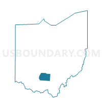
Outline

Summary
| Unique Area Identifier | 651356 |
| Name | SPRINGFIELD NORTH Voting District |
| County | Ross County |
| State | Ohio |
| Area (square miles) | 16.38 |
| Land Area (square miles) | 16.33 |
| Water Area (square miles) | 0.05 |
| % of Land Area | 99.68 |
| % of Water Area | 0.32 |
| Latitude of the Internal Point | 39.36918910 |
| Longtitude of the Internal Point | -82.91526870 |
Maps


Graphs
Select a template below for downloading or customizing gragh for SPRINGFIELD NORTH Voting District, Ross County, Ohio


Neighbors
Neighoring Voting District (by Name) Neighboring Voting District on the Map
- CHILLICOTHE 3-D Voting District, Ross County, OH
- CHILLICOTHE 3-E Voting District, Ross County, OH
- COLERAIN WEST Voting District, Ross County, OH
- GREEN SOUTH Voting District, Ross County, OH
- GREEN WEST Voting District, Ross County, OH
- HARRISON TWP Voting District, Ross County, OH
- SCIOTO B Voting District, Ross County, OH
- SCIOTO CENTRAL Voting District, Ross County, OH
- SPRINGFIELD SOUTH Voting District, Ross County, OH
- UNION CENTRAL Voting District, Ross County, OH
Top 10 Neighboring County Subdivision (by Population) Neighboring County Subdivision on the Map
- Scioto township, Ross County, OH (27,721)
- Union township, Ross County, OH (13,345)
- Green township, Ross County, OH (4,918)
- Springfield township, Ross County, OH (2,657)
- Colerain township, Ross County, OH (2,148)
- Harrison township, Ross County, OH (1,320)
Top 10 Neighboring Place (by Population) Neighboring Place on the Map
Top 10 Neighboring Unified School District (by Population) Neighboring Unified School District on the Map
- Chillicothe City School District, OH (23,467)
- Union-Scioto Local School District, OH (16,338)
- Zane Trace Local School District, OH (9,333)
- Southeastern Local School District, OH (6,519)
Top 10 Neighboring State Legislative District Lower Chamber (by Population) Neighboring State Legislative District Lower Chamber on the Map
Top 10 Neighboring State Legislative District Upper Chamber (by Population) Neighboring State Legislative District Upper Chamber on the Map
Top 10 Neighboring 111th Congressional District (by Population) Neighboring 111th Congressional District on the Map
Top 10 Neighboring Census Tract (by Population) Neighboring Census Tract on the Map
- Census Tract 9556.02, Ross County, OH (5,781)
- Census Tract 9566, Ross County, OH (5,244)
- Census Tract 9563, Ross County, OH (3,138)
- Census Tract 9556.01, Ross County, OH (2,207)